|
|||||||||||||||||||||||


 |
||
|
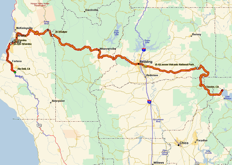
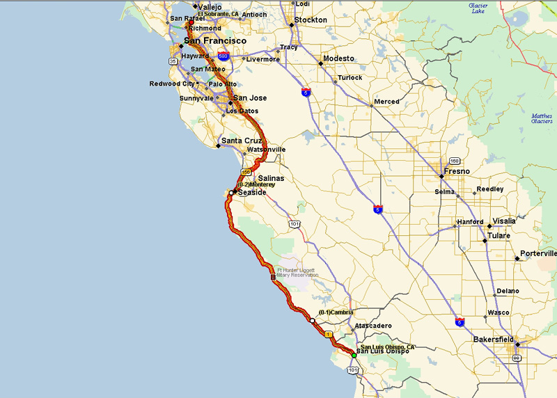
I had a free ticket from American Airlines that was due to expire (well actually was slightly expired but hey, I've got 1.3 million miles on American so they can afford to cut me a little slack) so on the advice of a couple of people I trust at work (you know who you are!), I booked my flight to San Francisco to do a week-long driving tour of Northern California. It was even better than they tried to explain! So here is the trip in pictures and comments. Bottom line: 1615 miles over the course of 5 1/2 days and I really enjoyed the whole trip. |
||
|
|
|
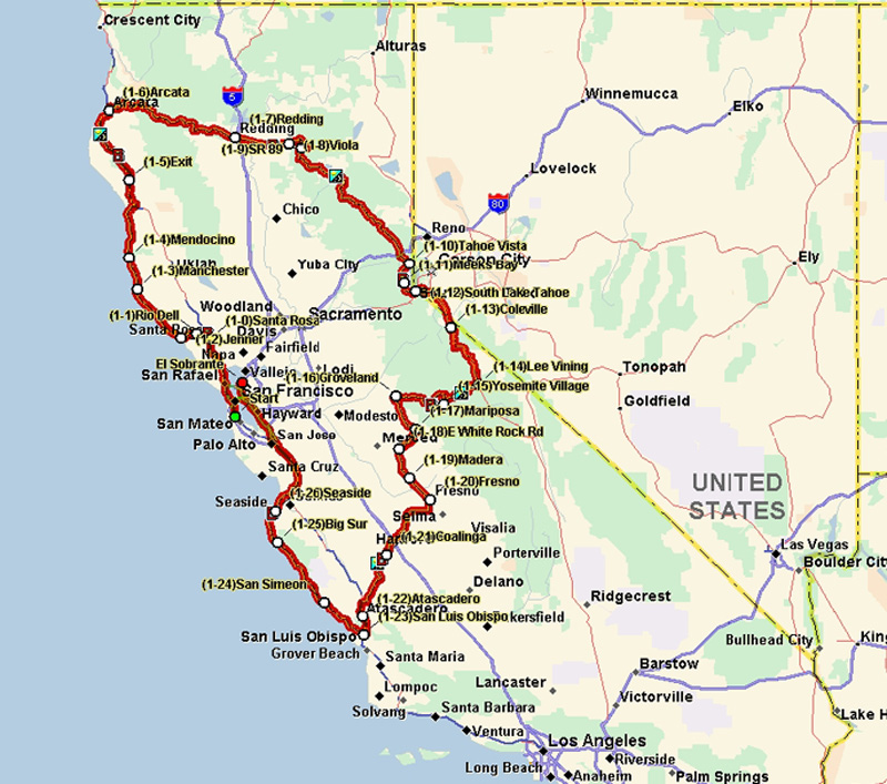
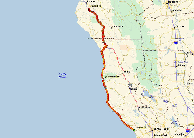
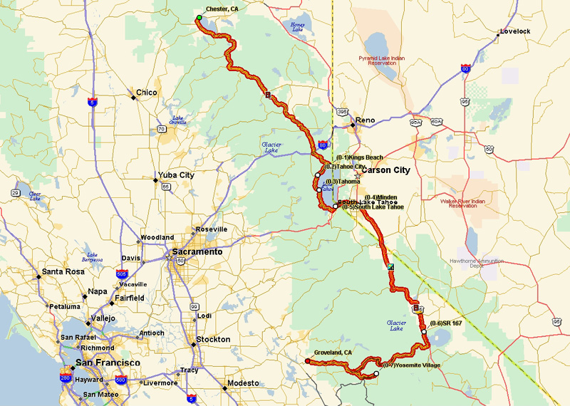
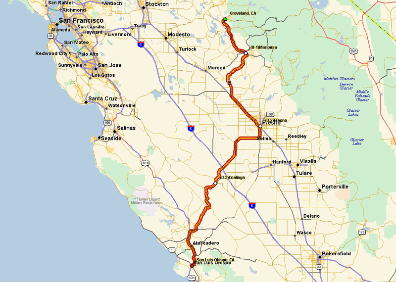
Here is a summary map of the whole trip. I bought a DeLorme Earthmate GPS LT-20 GPS antenna and software. The antenna plugs into the USB port of a laptop and drives the real-time directions facility of the software. I would give the system a B-. It does the main job but has some significant issues - which I'll highlight below as they come up. The maps below are generated by the software - you enter the starting point, vias (points along the way) and the ending point and it figures out the optimal route and gives you voice directions as you drive. Well, mostly... |
|||||||||||||||||||||||||||||
 |
|||||||||||||||||||||||||||||
 |
|||||||||||||||||||||||||||||
|
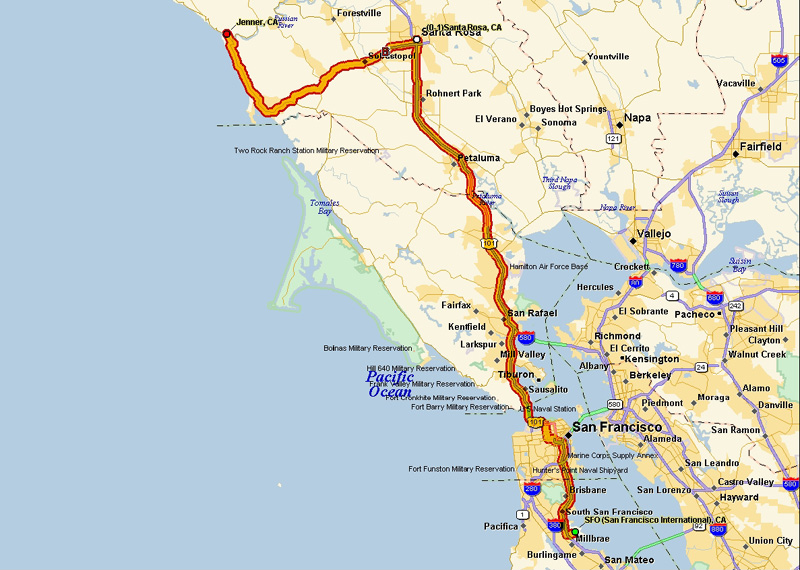
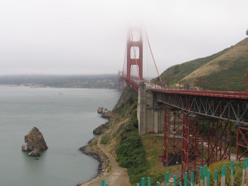
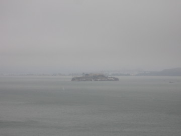
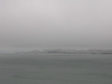
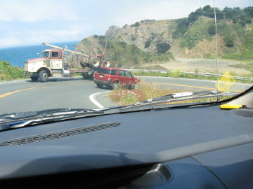
I arrived at San Francisco airport around noon, grabbed the rental car (Dodge Neon - cheap but small, light and powerful and handled well on the twisty roads). My first bad experience with the GPS was getting through downtown San Francisco on my way to the Golden Gate bridge to get across and start heading north. It put me on Market Street (going NE) and then insisted that I make a left turn to head NW towards the bridge. The only bad part is there are no left turns anywhere on that street that I could find - so it would tell me to turn left, I would yell at it that I couldn't and continue straight, it would then suggest left again at the next road, ... well you get the idea. Kinda put me off it right from the start. Anyway I finally made it to the Golden Gate bridge and the whole bay was shrouded in fog, as you can see. Then we have Alcatraz and the San Francisco skyline across the bay. |
|||||||||||||||||||||||||||||
 |
 |
||||||||||||||||||||||||||||
 |
 |
||||||||||||||||||||||||||||
|
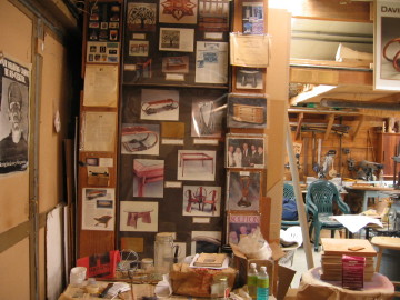
My first stop was in Santa Rosa to stop in at David Marks' workshop. I had emailed ahead to see if I could take a class on my way through on my vacation but he was scheduled to be teaching in Dallas. I stopped in to say hi to his wife Victoria on the way through and much to my surprise David answered the door! Turns out he was preparing for Dallas but hadn't left yet. David was unfazed at my sudden appearance at his door and asked if I wanted to see his workshop. Well let me grab the camera! |
|||||||||||||||||||||||||||||
 |
 |
||||||||||||||||||||||||||||
|
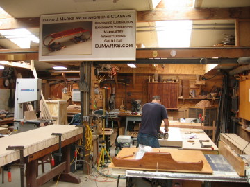
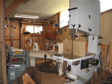
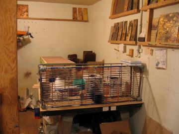
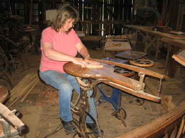
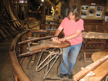
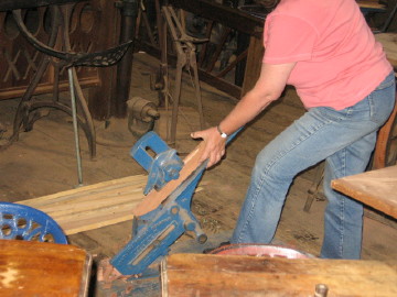
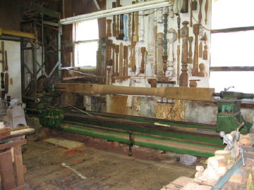
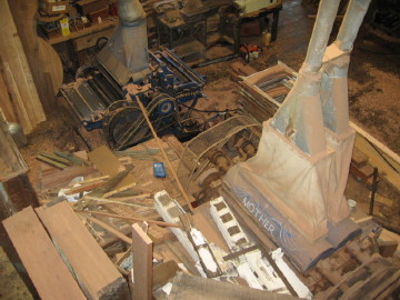
The shop is a lot smaller than you might think from watching the show - it's those clever Hollywood people and their camera angles. The first picture shows the left side wall as you walk in and displays many of David's projects over time. Moving forward you see the main shop room with the two workbenches and the tablesaw in the foreground. David's assistant Jerome Gerbasi is working on a torsion box made with ultralight 1/2" MDF. If you've worked with MDF before you know how heavy it is, but this stuff is very light. Below we see David's aircraft carrier-sized planer, along with his OneWay lathe and new 36" MiniMax bandsaw. David gave me some tips on bowl turning, after I described the problems I had trying to make bowls when I lived in Scotland. |
|||||||||||||||||||||||||||||
 |
 |
||||||||||||||||||||||||||||
|
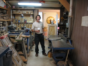
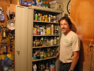
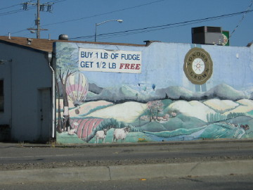
Next is the spray finish and patina room, with a metal cabinet for all of the explosive bits. Finally we pose by the band saw and then as I was leaving David started loading me up with walnut burl: a 12"x12" veneer slice, 4 pen blanks and a 10" diameter bowl turning blank. Now my karma must really be in good shape because less than a week after my trip I heard that David is coming to Austin to give a bowl-turning class on October 21. I got my name first on the list and will take David's bowl blank to the class. David had to get on a phone call to deal with the why his ISP deleted his 5000+ member mailing list. No backups, just deleted it. Duh! If you want to get on the new mailing list, go here. Leaving Santa Rosa I saw this fudge shop advertising their special - Damn you delicious fudge people! (Say it like Jon Stewart) |
|||||||||||||||||||||||||||||
 |
 |
||||||||||||||||||||||||||||
 |
|||||||||||||||||||||||||||||
 |
 |
||||||||||||||||||||||||||||
|
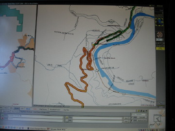
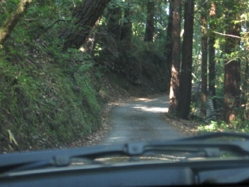
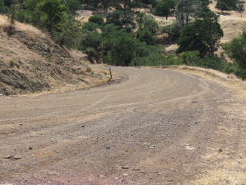
Heading towards the Pacific coast, I encountered another GPS "incident". As you can see on the map, the system proposed an opimal path shown by the thick orange line, rather than the light yellow highway that follows the west bank of the river. Since I was still new with the GPS I figured it knew best so I took that suggested path - you can see where I am on the path in the thick green line - and this is before the twists and steep sections really start. I suspected something was funny when the road started looking like the next picture. I finally had to give up when the "road" dead-ended in a Y - the left fork was a closed gate entering a farmer's field and the right fork was a closed gate into someone's driveway. So I had to go all the way back down the twisty hill to the yellow highway following the river... |
|||||||||||||||||||||||||||||
 |
 |
||||||||||||||||||||||||||||
|
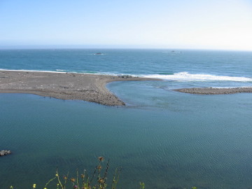
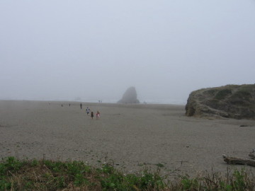
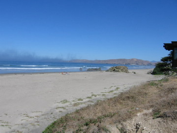
After I got back on track, the river took me right to the Pacific coast. These are my first views of the ocean. |
|||||||||||||||||||||||||||||
 |
 |
||||||||||||||||||||||||||||
 |
 |
||||||||||||||||||||||||||||
|
I had dinner at the Timber Cove Inn and stayed in a nice oceanview cabin at the Fort Ross Lodge, both in Jenner, CA. |
|||||||||||||||||||||||||||||
 |
|||||||||||||||||||||||||||||
|
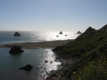
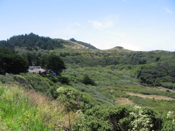
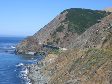
Day 2 was spent doing hard left and right turns as the road twists and turns to follow the coastline, with many small canyons cutting down from the right. There are many turnouts that allow drivers to pull over and let other traffic past - everyone was very courteous, except You - Old Man in the Saab from Walnut Creek! You know who you are! Every new view was beautiful. In some places there are very steep cliffs with wind-battered trees and in other places there are wide, gently sloping plains. In some places the sun was out, in other places there was dense fog. |
|||||||||||||||||||||||||||||
 |
 |
||||||||||||||||||||||||||||
 |
 |
||||||||||||||||||||||||||||
 |
 |
||||||||||||||||||||||||||||
 |
 |
||||||||||||||||||||||||||||
|
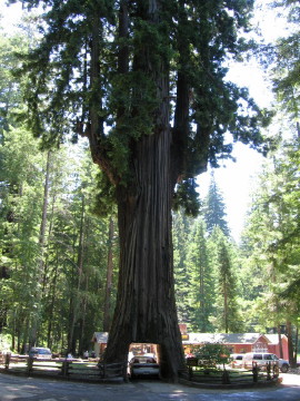
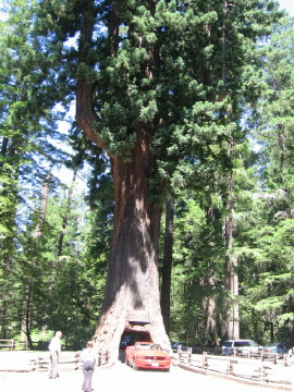
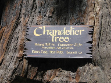
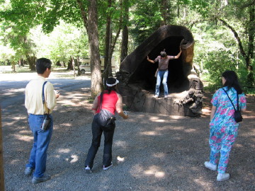
I cut inland and got on Hwy 101 to enter the heart of the Redwood forests. I saw a sign for The Chanelier Drive Through Tree just north of Leggett and just had to see it with my own eyes. The cut was made in the mid-1930s and the tree is still healthy so I guess the circulatory system is still working in the remaining trunk. Not bad for a 2400 year old tree. And of course there was a busload of Japanese tourists! |
|||||||||||||||||||||||||||||
 |
 |
||||||||||||||||||||||||||||
 |
 |
||||||||||||||||||||||||||||
|
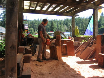
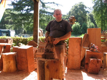
Just up the road I came to Garberville where I bought a redwood flower vase for my mother's birthday at Chris Leonard's One Log House gift shop. Chris was a serious woodturner for many years before he opened the store. At the next building over I found Steve Anderson at the Grandfather Tree, who has been doing chainsaw carving for 19 years. He says his smallest saw is the safest due to the small diameter of the bearing at the tip - less chance of kick. Here he poses with a bear cub he carved in about 30 minutes. |
|||||||||||||||||||||||||||||
 |
 |
||||||||||||||||||||||||||||
|
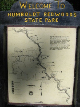
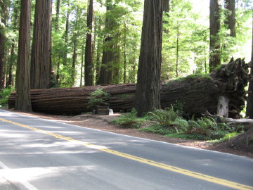
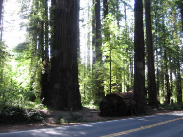
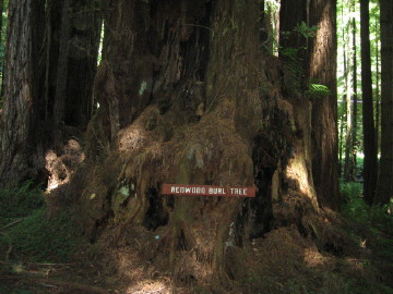
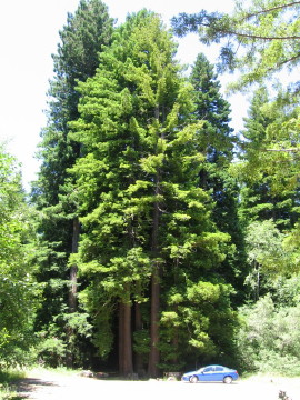
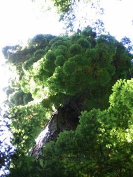
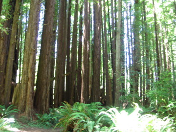
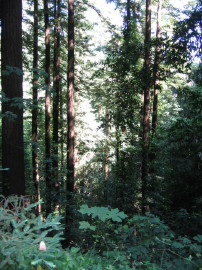
About 2/3 of the way through the day's drive, I entered the Avenue of the Giants - a 31 mile section of the road going through Humboldt Redwoods State Park which has the largest remaining stand of virgin redwoods in the world. The size of these trees just staggers the mind - I walked around the base of one I saw, as closely as I could and it took 23 strides to get all the way around. |
|||||||||||||||||||||||||||||
 |
|||||||||||||||||||||||||||||
 |
|||||||||||||||||||||||||||||
 |
 |
||||||||||||||||||||||||||||
|
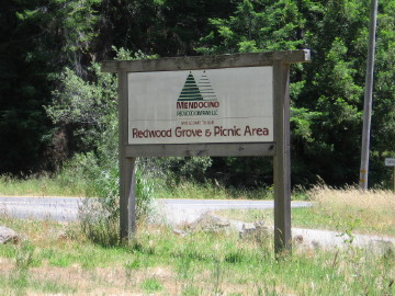
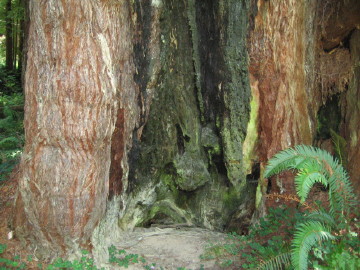
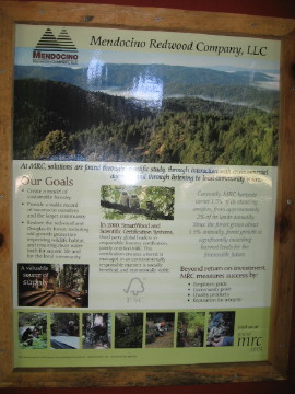
I came across a former redwood logging site, now protected, with a path and marked with signs. Some of the old tools are still in place, back when the logging was done with hand saws and horse-drawn carts. The site is sponsored by the Mendocino Redwood Company so they try to put the best spin on the situation. Being both an environmentalist and a woodworker, I was torn between wanting to see these forests stay just like they are and doing sustainable logging to provide a very unique and useful wood for the world. If I remember right, the non-protected forests are being logged at a rate of around 1% per year while the forest naturally regrows at around 2.5% so the world's count of redwoods is actually increasing. The only issue is the very old-growth trees - the industry has agreed to leave those in the forst and only harvest trees in the 30 - 50 year range (if I remember right). There are signs of a fire in this forest in the past, probably 300 - 400 years ago. Since redwood doesn't rot quickly anything left in the woods (stumps, fall-overs) acts as a platform for new life. |
|||||||||||||||||||||||||||||
 |
 |
||||||||||||||||||||||||||||
 |
 |
||||||||||||||||||||||||||||
 |
 |
||||||||||||||||||||||||||||
|
You can see the scale of the trees against my car in the shot below - and these aren't the tallest ones I saw. Next is the sign from the timber company giving their side of the story. |
|||||||||||||||||||||||||||||
 |
 |
||||||||||||||||||||||||||||
|
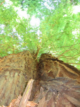
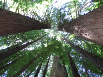
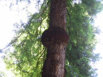
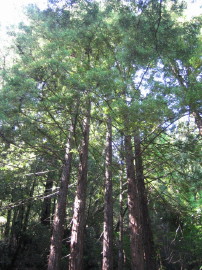
Here I'm making myself dizzy looking straight up into the canopy. On the left, something happened to the trunk and the tree healed itself. I liked the pom-pom look of foliage of this next tree. |
|||||||||||||||||||||||||||||
 |
 |
||||||||||||||||||||||||||||
 |
|||||||||||||||||||||||||||||
 |
|||||||||||||||||||||||||||||
 |
|||||||||||||||||||||||||||||
 |
|||||||||||||||||||||||||||||
 |
|||||||||||||||||||||||||||||
|
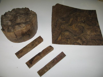
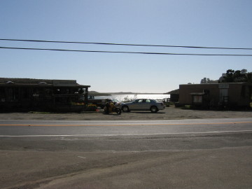
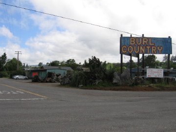
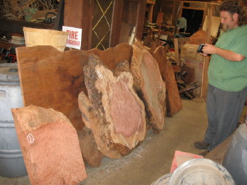
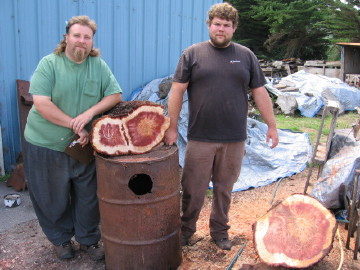
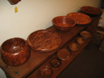
I chose to stay overnight in Rio Dell (or Real Dull as the motel clerk called it...) because of the timber mill in the next-town-over Scotia, the company-owned town for Pacific Lumber Company. The tour book I have said the sawmill has a tour - I arrived in the late afternoon after everything closed so I went back first thing the next morning only to find that half the mill has been dismantled and sold off, and the tour through the new mill wasn't going to be ready for at least 6 months. Oh well Coming north into Fortuna I spotted a building on the side of the road marked Burl Country. OK, so I'm a wood geek and I have to go in. There I met Nathan Willis who reclaims redwood from stumps and sells everything from single pieces to palette loads to slabs. He has a very impressive stockpile and also does some turning himself, as you can see. I bought two bowl blanks - one redwood birdseye and one redwood lace. Nathan wants everyone to know that the pictures on his web site are NOT available - they've already been sold over the years - if you're interested, send him a description of what you're looking for and he will locate something in his stock and email you back a picture. |
|||||||||||||||||||||||||||||
 |
 |
||||||||||||||||||||||||||||
 |
 |
||||||||||||||||||||||||||||
|
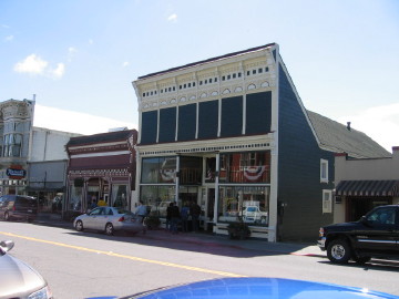
I decided to take a small diversion over to Ferndale, a small town with a flair for Victorian architecture. It has used as a setting for several films including Outbreak and The Majestic. |
|||||||||||||||||||||||||||||
 |
 |
||||||||||||||||||||||||||||
|
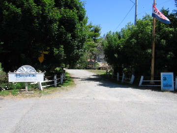
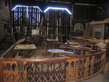
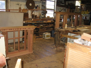
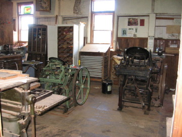
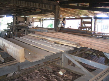
Continuing north to Eureka I found the Blue Ox Millworks. The Blue Ox is steeped in the history of old-time woodworking and serves as part museum, part restoration woodworking mill and part classroom. The collection of tools is impressive and their dedication to teaching doubly so. Below are the entrance and the first part of the huge antique barn with the human-powered tools. The machine in the lower right makes fence pickets in two pulls of the lever. |
|||||||||||||||||||||||||||||
 |
 |
||||||||||||||||||||||||||||
 |
 |
||||||||||||||||||||||||||||
 |
 |
||||||||||||||||||||||||||||
|
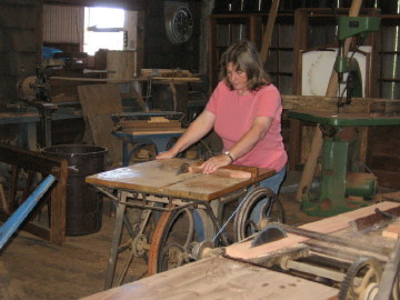
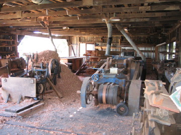
Moving into the powered part of the barn we see the 15' long lathe and the two huge planers. The big tools have been converted from belt drive to electricity. They are building period-style window frames for a customer project. They also have working printing presses. |
|||||||||||||||||||||||||||||
 |
 |
||||||||||||||||||||||||||||
 |
 |
||||||||||||||||||||||||||||
|
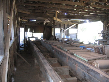
The Blue Ox can do every step of the process from tree-trunk to finished pieces. These pictures show the sawmill for making planks and moldings. |
|||||||||||||||||||||||||||||
 |
 |
||||||||||||||||||||||||||||
 |
|||||||||||||||||||||||||||||
|
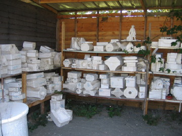
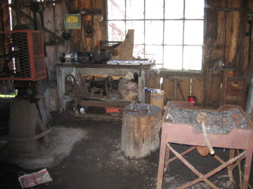
They also have a blacksmith shop and ceramic studio. Very impressive all around! |
|||||||||||||||||||||||||||||
 |
 |
||||||||||||||||||||||||||||
|
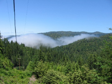
After Eureka, I cut east across the Coast Range mountains toward Lassen Volcanic National Park. Up and down, right and left through beautiful scenery. |
|||||||||||||||||||||||||||||
 |
 |
 |
|||||||||||||||||||||||||||
|
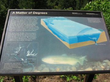
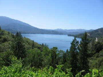
Then I came across a sign that said "Do Not Pick Up Hitchhikers". "Strange..." I thought to myself until about a mile down the road I saw a sign for the Whiskeytown Juvenile Detention Center (or something like that). Well maybe if the whole town wasn't crazy about whiskey they wouldn't have problems with their children??? :^) They have a huge park around the lake there, dedicated by John Kennedy, which was built as a reservior to feed water down to the huge agricultural farms in the San Joachin valley down south. The lake has plastic curtains that keep cold water from mixing with warm water - this ensures that the salmon can spawn successfully. |
|||||||||||||||||||||||||||||
 |
 |
||||||||||||||||||||||||||||
|
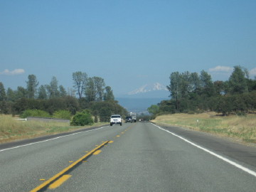
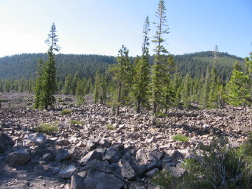
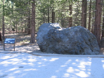
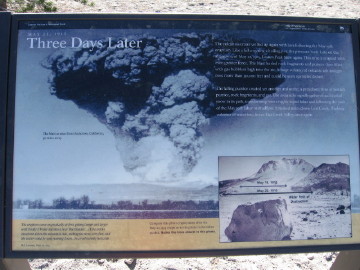
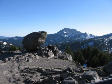
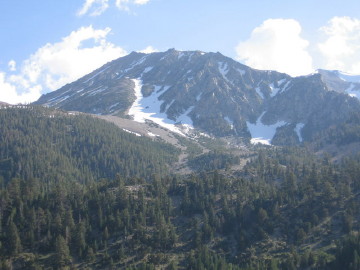
My next stop was at Lassen Volcanic National Park. There's nothing like hot magma to make the trip a little more exciting. This long view is my first sight of the snow-capped peak. The park is fairly small but has a wide variety of scenery - the rubble area below is called Chaos Crags - full of broken lava chunks. Driving the ring road around the peaks I came across the Hot Rock - a 300 ton boulder thrown miles and carried downhill by lava rivers during the 1915 eruption. |
|||||||||||||||||||||||||||||
 |
 |
||||||||||||||||||||||||||||
 |
 |
||||||||||||||||||||||||||||
|
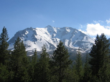
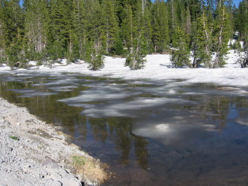
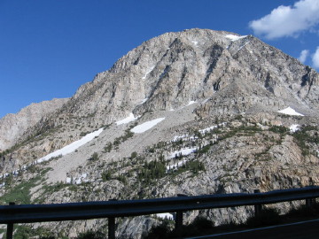
In this picture you can see how the whole flank of the mountain blew off during the eruption - a very similar look to Mt. St. Helens after it's eruption. At this altitude there was still snow and ice in this pond at the beginning of July. |
|||||||||||||||||||||||||||||
 |
 |
||||||||||||||||||||||||||||
|
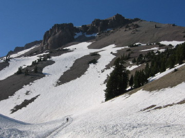
The first picture is the very top of the peak - topping out at 10,457', another 2000' above where I took this. The much larger ancient volcano has subsided and been eroded away by glacial activity, leaving a ring of peaks and strangely deposited rocks. |
|||||||||||||||||||||||||||||
 |
 |
||||||||||||||||||||||||||||
|
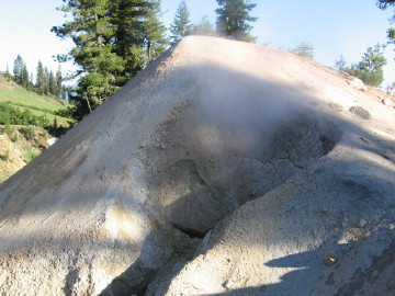
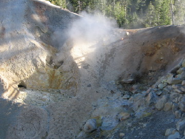
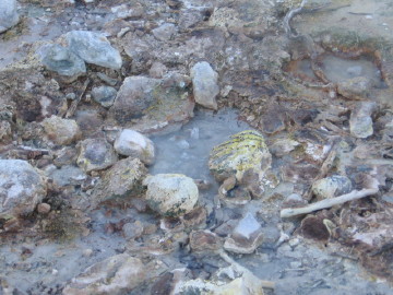
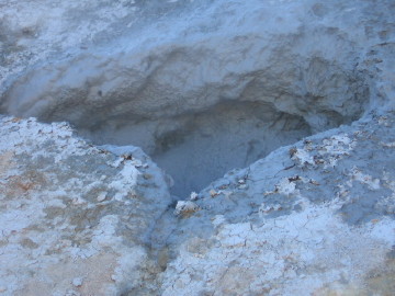
Finally I came to the still-active part of the mountain - sadly not active lava vents but cool just the same. There are several vents and bubbling mud pools in the Sulphur Works area. It's too bad you can't hear the sounds - a lot of hissing and bubbling and in the thick mud pool a "bloop" sound, and the pungent smell of H2S and SO2. "Launch the subterranean probe!" Oh, sorry. |
|||||||||||||||||||||||||||||
 |
 |
||||||||||||||||||||||||||||
 |
 |
||||||||||||||||||||||||||||
|
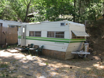
Leaving Lassen Park, I drove southeast and stayed overnight in Chester. I wouldn't recommend the Timber House restaurant - the building itself is cool - built by one guy, by hand, out of slabs of wood he cut down himself. The party at the next table to me almost walked out after waiting for over 2.5 hours with only two other tables of customers in the whole restaurant. My dinner came quickly but I had decided to treat myself to a filet mignon and they just killed it - way past well done, dry and no flavour at all. They wouldn't give me a discount but did give me a free piece of frozen cheesecake. Not worth it... |
 |
|
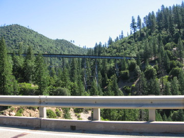
My goal for the day was to get to Yosemite National Park. It was a long day of driving with Lake Tahoe as the only expected item of interest. Right after Chester it was up and down through the Sierra Nevada range. The first pictures are of a long span across a river and a small rail tunnel drilled right into the slope. |
 |
 |
||||||||||||||
|
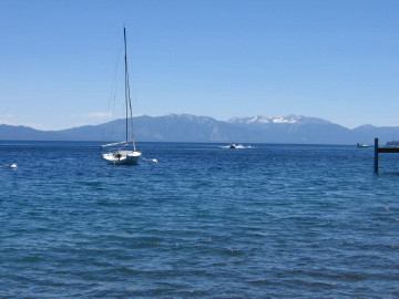
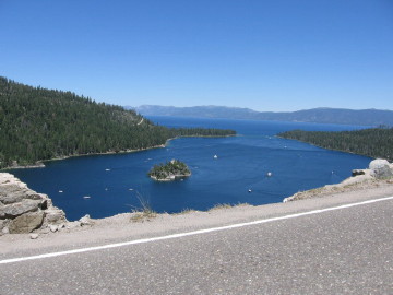
Lake Tahoe comes out of nowhere - and you can smell the money as you arrive in town. Too many Starbucks, yoga studios and new age book stores to count... Also a couple of very sweet Ferraris. Oh well I can dream. The lake itself is very beautiful and this is just the summer. Skiing is big in the winter due to the close proximity of the mountains. |
|||||||||||||||
 |
 |
||||||||||||||
|
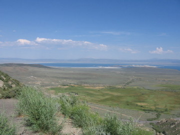
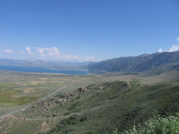
The best way to get from Lake Tahoe to Yosemite is to take a big highway, that's actually just across the border in Nevada, then cut back over the Sierra Nevada mountains. Just before cutting over I came to Mono Lake. It is a huge natural bowl and is believed to be the longest continuously wet body of fresh water on Earth. Pretty cool. |
|||||||||||||||
 |
 |
||||||||||||||
|
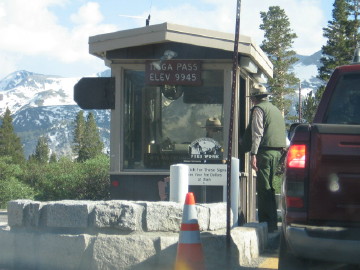
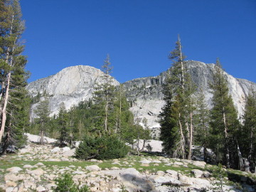
I finally arrived at the eastern gate of Yosemite National Park, at 9,945'. The park is HUGE and to come in from the east you have to go in a very long counter-clockwise circle to get to Yosemite Village, at the "heart" of the park. |
|||||||||||||||
 |
 |
||||||||||||||
 |
 |
||||||||||||||
|
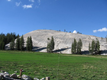
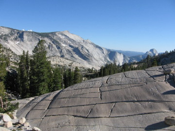
There are a lot of rock features including some perfectly smooth rock with glacial scrape marks and others with sheer vertical faces. |
|||||||||||||||
 |
 |
||||||||||||||
 |
 |
||||||||||||||
|
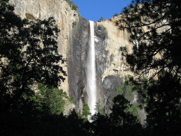
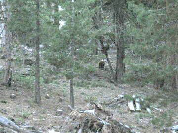
I finally arrived in Yosemite Village where the big waterfalls are located. The first step to protect the area was taken by Abraham Lincoln in 1864 and new sections were added until it was declared a National Park in 1890. Besides the incredible scenery, El Capitan is the tallest granite monolith in the world and Yosemite Falls, at 2,425' is the 5th highest waterfall in the world. And yes, that is a bear in the woods but he was out of sight before I could ask... :^) |
|||||||||||||||
 |
 |
||||||||||||||
|
One thing you must be aware of - unless you bring your own tent and camping equipment you need to book one of the few motel rooms in Yosemite Valley about a year in advance. Even if you want to camp you might not be able to find a space depending on time of year, holiday weekend, etc. When night fell, I had to drive west out of the park and checked several motels along the way. I finally found one in Garberville that was almost sold out, but had a "special" room for the amazing price of $60 / night. Let's just say the bed and the pillow worked well. The shower, well... |
|||||||||||||||
 |
|||||||||||||||
 |
|||||||||||||||
|
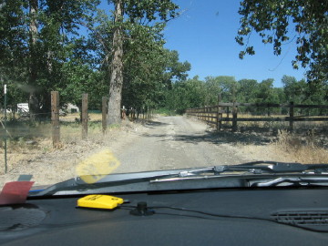
Because I had to travel so far out of Yosemite to find a place to stay I decided to keep going and was ahead of schedule, so instead of cutting directly west to San Francisco, I went almost straight south across the San Joachin valley and down to San Luis Obispo. Crossing over the western foothills of the Sierra Nevadas was an interesting time. The GPS told me there was a clear, easy road that would take me exactly where I needed to go. As I went up the road was OK but then it turned to gravel. Given my history with the thing, I had to gamble that the road would go all the way over the peak, or turn around and go further south and try again. I decided to continue and was pleasantly surprised when the road crossed the peak and down the other side and turned to ashphalt again. My joy was short-lived though, when I was passing through a small town the GPS told me the road I was on had a dead end - I couldn't get to the other side of a creek and had to cut a few streets north. The second picture is where the GPS wanted me to go, right into someone's driveway. I went back to the main road and went straight through the "dead end" and across to the other side of the creek and beyond. |
|||||||||||||||
 |
 |
||||||||||||||
|
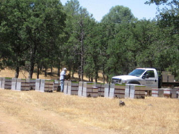
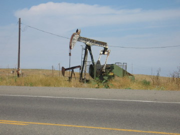
I drove through Raisin City - which is more like "Raisin Two Buildings" - in the heart of the grapes-for-raisins growing region. The San Joachin valley produces around half of all agricultural products in the whole U.S. I saw fields growing all kinds of things and some livestock pens too. I stopped for gas at one point and a dump truck pulled up that was emitting THE WORST smell I've ever smelled in my life. The driver said he had just dropped off a load of "chicken guts". Imagine that sitting in 100F heat. I came across a bee keeper working on his hives in a field. The next picture shows the famously decorated oil rigs in Coalinga - all painted to look like animals. |
|||||||||||||||
 |
 |
||||||||||||||
|
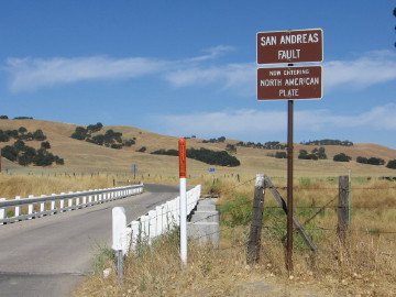
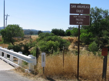
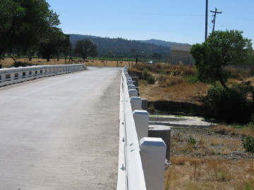
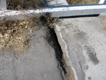
I saw a town called San Andreas marked on the map but it was too far north for me to hit, so I was really surprised to come across the fault itself - where the North American and Pacific plates come together. The bridge is built to be suspended between the sides, but you can see there has been some movement over time. |
|||||||||||||||
 |
 |
||||||||||||||
 |
 |
||||||||||||||
|
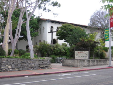
I arrived in San Luis Obispo and turned into the first motel off the highway. It was a Days Inn and turned out to be great. I asked if they had any rooms with wireless Internet so they upgraded me to a suite with wireless at no charge! I relaxed in the hot tub (hey, it's California), had a shower to get all of the road dust off me and then walked downtown to see the sights and grab some dinner. The first picture is the historic old Mission and the second shows one of the highly decorated fish statues that are found around the city. I could see the design of most of them from a distance but there was one I couldn't figure out - as I got closer and read the sign - it was finger-painted by a kindergarten class! Well that explains it. I really liked this town and immediately started coming up with cunning plans to move here and start up a custom furniture business for all of the rich people that live in the area. The only problem is you have to be rich to live in the area - Catch 22! |
|||||||||||||||
 |
 |
||||||||||||||
 |
|||||||||||||||
|
After pinging friends in the San Francisco area and arranging to stay overnight, I made a leisurely drive up the coast road. I passed through Big Sur which is famous for the road washing out in landslides. The landslide area is actually a little south, not in Big Sur itself because the village is actually a few miles inland. |
|||||||||||||||
 |
 |
||||||||||||||
|
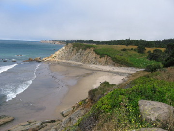
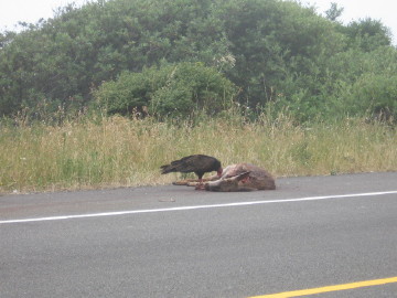
I passed a "Deer on the Road" icon sign and wouldn't you know it a little further north I came across this demonstration of the circle of life (ever seen The Lion King?). There were actually about 6 vultures partaking of the buffet but this was the only guy that didn't fly away as I slowly rolled up. Further up the coast I saw this unusually-shaped island - it's a state park and has a lighthouse on top. It is located right next to a jail of some kind so there are all kinds of No Parking signs - there was no traffic anywhere near so I slowed down to a crawl to take this picture - don't want to get in trouble! FL:ASH: Alert reader "Thane" emailed me this information about the lighthouse: That was the Big Sur lighthouse you saw on your trip. The Jail used to be a Navy listening post for Russian subs. One of my friends children, a Forest Ranger, and the local Highway patrol lived in the "jail" for free. I have been up into the lighthouse a base that goes back to almost the Civil War. Used to haul supplies up a mini rail in carts from supply boats. Next time your out they have a tour from Big Sur Forest. Now my friends kids and the other rangers have been thrown out because of mold complaints by one employee, they believe. Highway patrol still lives there. |
|||||||||||||||
 |
 |
||||||||||||||
|
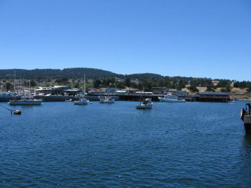
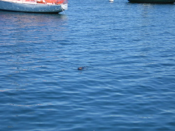
My last stop before the end was in Carmel / Monterrey. This is another very rich area with a great bay and marina - just ask this sea otter. |
|||||||||||||||
 |
 |
||||||||||||||
|
The last, and most unimpressive stretch of road was the superhighway from Monterrey to El Sobrante, which is near the coast of the penninsula north of Oakland. It was great to relax with Kimberly and Aidon, drink 25-year-old The Macallan, eat steak and cheesecake and watch hidden scenes on the Lord of the Rings DVD. It was strange to be so close to a big city but have the ability to see deer walk past the house, raise chickens, and use borrowed sheep for mowing the grass. Unfortunately my time was up and I had to get up before dawn to catch my flight back to Austin and civilization. |
|||||||||||||||